Eliminate guesswork and delays. Access field data at affordable rates on construction plans for precise site intelligence, progress tracking, and safety oversight through our aerial construction platform. Time-proven technology for better-run projects.
High-resolution topographical mapping, existing condition documentation, and precise locating for optimized planning.
Objective monitoring and of earthwork, excavations, structure completion, and schedule via orthomosaics and 3D models.
Objective monitoring and of earthwork, excavations, structure completion, and schedule via orthomosaics and 3D models.
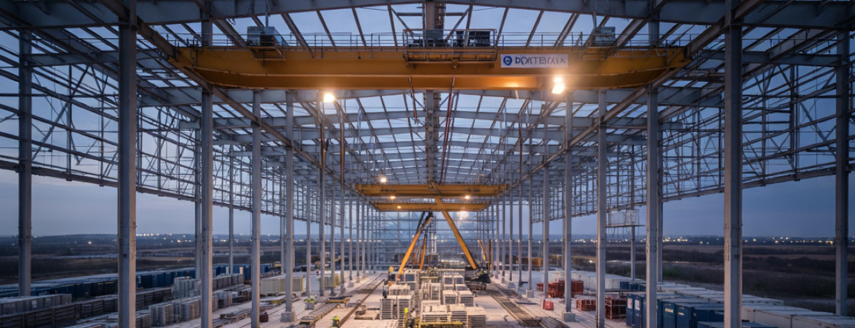
Modern construction sites are under relentless pressure—from OSHA compliance and shrinking budgets to tight timelines, complex logistics, and demanding stakeholders. Juggling it all while keeping quality high, verifying progress, and avoiding costly rework or equipment failures is a constant challenge. Without timely, accurate site data, small issues snowball into delays, budget blowouts, safety lapses, and disputes that kill momentum.
Stop managing blind. Raad provides immediate access to expert drone pilots equipped for the rigors of active construction sites. Gain unparalleled real-time visibility into site conditions, track progress objectively against your BIM models, identify structural or thermal issues before they escalate, enhance safety protocols, and streamline reporting – all through high-resolution aerial data delivered securely and on your schedule.
High-resolution (LiDAR) topographical mapping, existing condition documentation, cut/fill analysis, and utility locating for optimized planning.
Objective, quantifiable monitoring of earthwork, foundations, structural erection, MEP installation, and facade progress via orthomosaics, 3D models, and detailed visual reports. Compare as-built progress directly against design plans and BIM models.
Accurately calculate volumes of earthwork, aggregate, and other materials for inventory management and progress billing.
Detect hidden moisture intrusion, energy loss, electrical system hotspots (substations, switchgear), HVAC anomalies, and roofing defects early to prevent costly failures and ensure quality. Crucial for data center commissioning and ongoing facility management.
Enhance site safety with aerial oversight of fall protection, hazard identification, traffic management, and equipment placement. Monitor security perimeters and access points.
Safely inspect roofs, facades, structures, and critical infrastructure (cooling towers, generators) during construction and post-handover for quality assurance and maintenance planning.
Capture compelling aerial photos and videos throughout the project lifecycle for engaging marketing materials, investor updates, and client presentations.
THE ROI OF AERIAL INTELLIGENCE
Accelerate data capture and reporting for faster decision-making, proactive problem-solving, and reduced inspection times.
Detect deviations, clashes, and potential failures early to minimize costly rework, material waste, and warranty claims.
Minimize the need for workers in hazardous areas, streamline safety audits, and stay ahead of OSHA violations with full-site visibility.
Verify work conforms to design specifications with accurate as-built data and detailed visual documentation.
Provide clear, objective, and easily shareable visual progress reports to clients, investors, and internal teams.
Maintain an indisputable visual record for progress billing verification, dispute resolution, and project archiving.
"Raad's aerial reports gave us exactly what we needed during our site due diligence and early pre-construction phases — clear, on-time, knowledgeable pilots that provided detailed and accurate visibility of the entire site. We were able to quickly identify site drainage issues and topographic shifts and map utility lines and existing structures. Raad's collected data helped us make informed decisions and move faster with fewer surprises. It's now a critical part of how we plan major projects from early due diligence through the entire construction process. Whether you're mapping a 10 acre or 10,000 acre site, we highly recommend the use of drone mapping and of course our friends at Raad!"
Joe Ryan
- Ryan Real Estate & Technologies Advisors, Inc.
Every pilot in our network undergoes rigorous verification of certifications, insurance coverage, equipment maintenance, and operational procedures. Our ongoing quality assurance ensures consistent deliverables regardless of project location.
Commercial drone operation certification required for all professional pilots
Night operations, flying over people, and other special authorizations
Specialized training for specific industries and operations
For initial flights, we typically deploy local pilots within 24-72 hours. We then collaborate with you to establish a reliable, recurring schedule (e.g., weekly, bi-weekly, monthly) tailored to your project's reporting needs and milestones.
Absolutely. We deliver data in standard industry formats (GeoTIFF, LAS, OBJ, JPEG, MP4) designed for seamless import into popular project management, design, and analysis platforms. Let us know your specific software needs.
Safety is paramount. Pilots adhere strictly to all site-specific safety requirements (PPE, check-in/out, communication protocols, restricted zones) provided by your team, coordinate flight plans with site management, and maintain constant situational awareness.
Drone-based photogrammetry typically provides volume measurement accuracy within 1-3%, significantly more accurate and faster than traditional methods. Accuracy depends on factors like ground control points (GCPs) used. We can discuss your specific accuracy requirements.
Ready to gain complete control and visibility over your construction projects? Discuss your specific needs with a Raad.com construction solutions expert and get matched with specialized pilots nationwide.