
LiDAR vs Photogrammetry
Is LiDAR or Photogrammetry Better for Mapping and Inspections in 2025? A comprehensive comparison of LiDAR workflow vs. drone photogrammetry to help you choose the right technology for your project.
Read More →A comprehensive guide to standard operating procedures for photogrammetry mapping projects, covering accuracy, fidelity, and actionable data delivery.
Mapping jobs span many industries, but to establish a go-to workflow for any mapping project, I've created this article outlining key procedures essential to every mapping job.
Maps may be created and analyzed for a wide variety of reasons but it's almost always true that the client wants to see their asset from their computer. The map you make will show their assets from near-earth and recently. It's true these assets can often be viewed from satellite imagery, but often that imagery is old, inaccurate and lacks enough detail. The map you provide on the other hand will be recent, accurate and detailed. In addition to that, the software you use to process the data will typically have some really powerful analytical tools to help your client pull actionable data.
Fill out a pilot profile on RAAD.com now and start receiving mission opportunities.
Mapping involves some basic geospatial scientific knowledge. You need to have a basic understanding about what factors influence the data that a drone captures. To provide actionable data, we need to take a look at two overarching topics: Accuracy and Fidelity.
Factors to consider: GNSS strength, RTK availability, Ground Control Points (GCPs), Equipment maintenance, environmental conditions, vertical and horizontal datums (though datums may not affect accuracy, it certainly dictates whether or not your data is actionable).
Fidelity refers to the level of detail and resolution in your mapping data. Higher fidelity means more detailed imagery and more precise measurements. Key factors that affect fidelity include:
Successful mapping missions begin with thorough planning. This includes site reconnaissance, weather assessment, airspace authorization, and mission parameter optimization. Understanding your client's specific accuracy requirements will help determine the appropriate GSD, overlap settings, and whether ground control points are necessary.
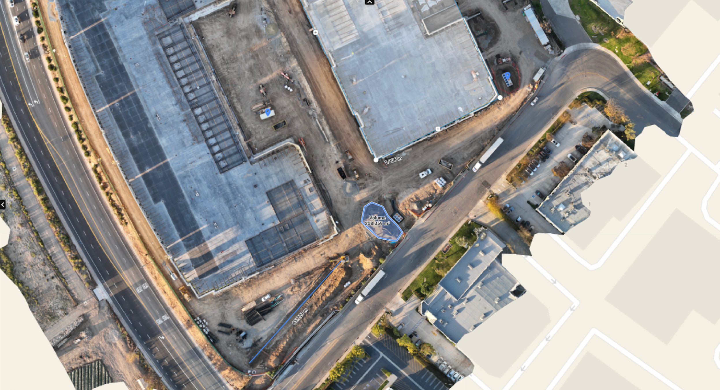
Raw imagery from your mapping mission needs to be processed into actionable deliverables. Modern photogrammetry software can generate orthomosaics, digital elevation models, point clouds, and volumetric calculations. The key is understanding which deliverables your client needs and processing the data accordingly.
Before delivering your mapping products, implement quality control checks to ensure accuracy standards are met. This includes reviewing tie point distributions, checking for processing artifacts, and validating measurements against known reference points when available.
Fill out a pilot profile on RAAD.com now and start receiving mission opportunities.

Chief Growth Officer
Career drone pilot building a drone services network that actually works.
Is LiDAR or Photogrammetry Better for Mapping and Inspections in 2025? A comprehensive comparison of LiDAR workflow vs. drone photogrammetry to help you choose the right technology for your project.
Read More →