

From flight to insight, we deliver the ground truth about your assets at scale
—so you can act with confidence when it matters most.
Trusted by

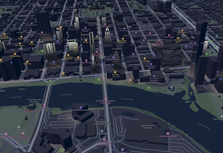
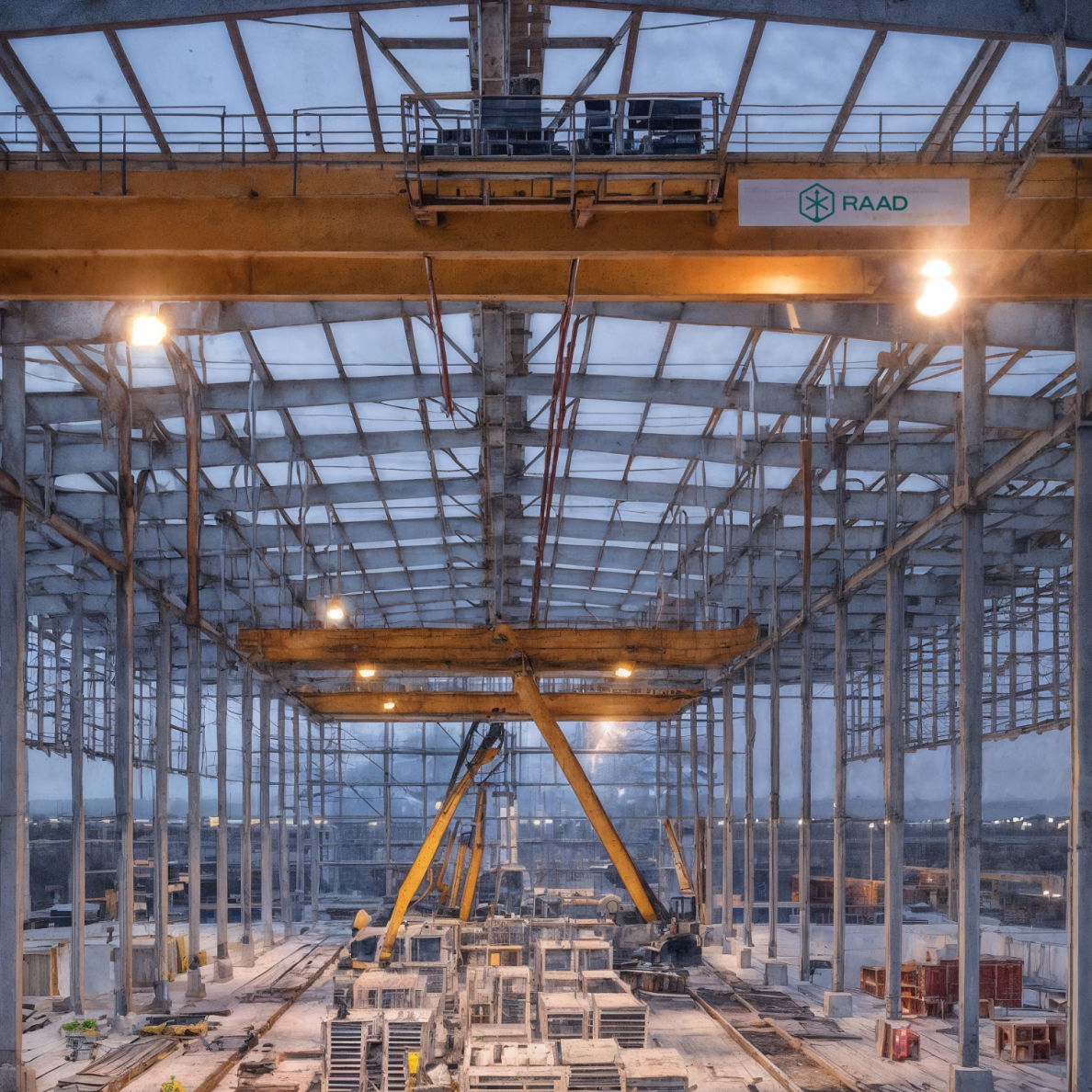
The #1 reason construction projects slip - bad site data. Raad is a turnkey solution for aerial documentation. From construction progress updates to LiDAR topography to stockpile volumetrics, Raad has you covered.
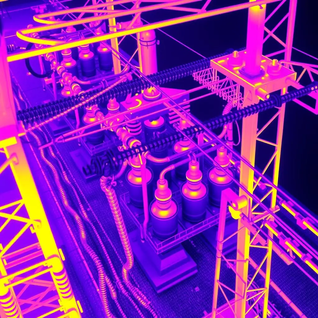
Monitor transmission & distribution assets in high-resolution, prevent catastrophe risk, eliminate truck rolls, and lower SAIFI/SAIDI. Raad standardizes mega-scale pilot coordination and data capture to monitor for insulator damage, power line sag, pole health, and vegetation encroachment.
Simplify telecoms and fiber infrastructure monitoring with Raad's standardized solutions. Our pilots deliver precision tower inspections, civil surveys, line-of-sight verification, and damage reports.

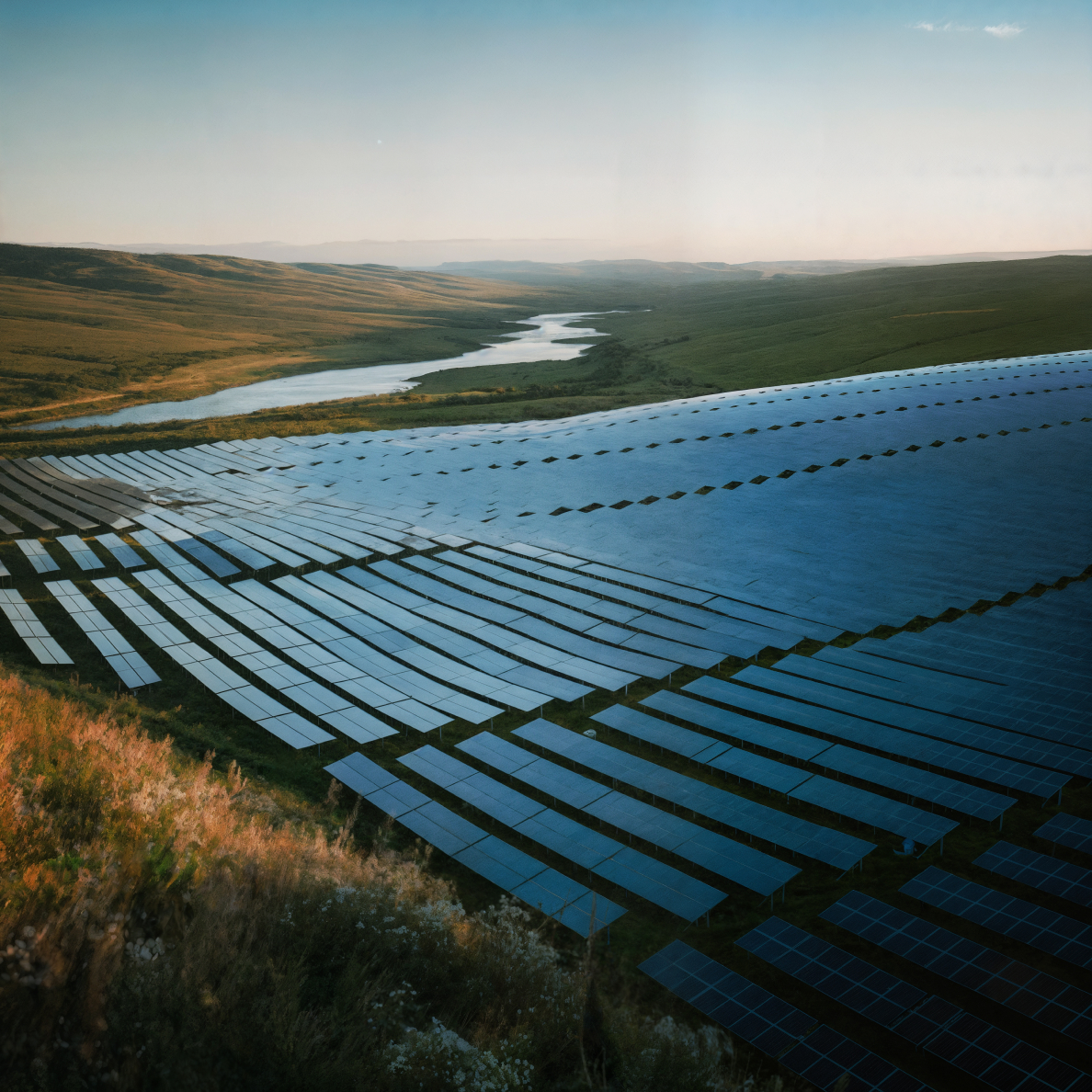
From site scouting to commissioning to O&M, Raad delivers fast, high-resolution imagery and analysis to accelerate development, verify builds, and keep assets performing. —Detect defects. Monitor progress. Maximize yield.
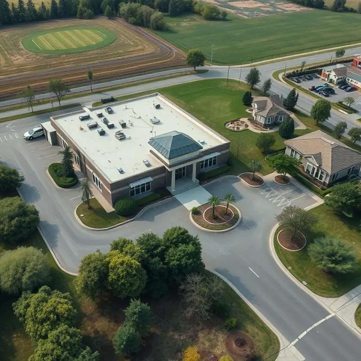
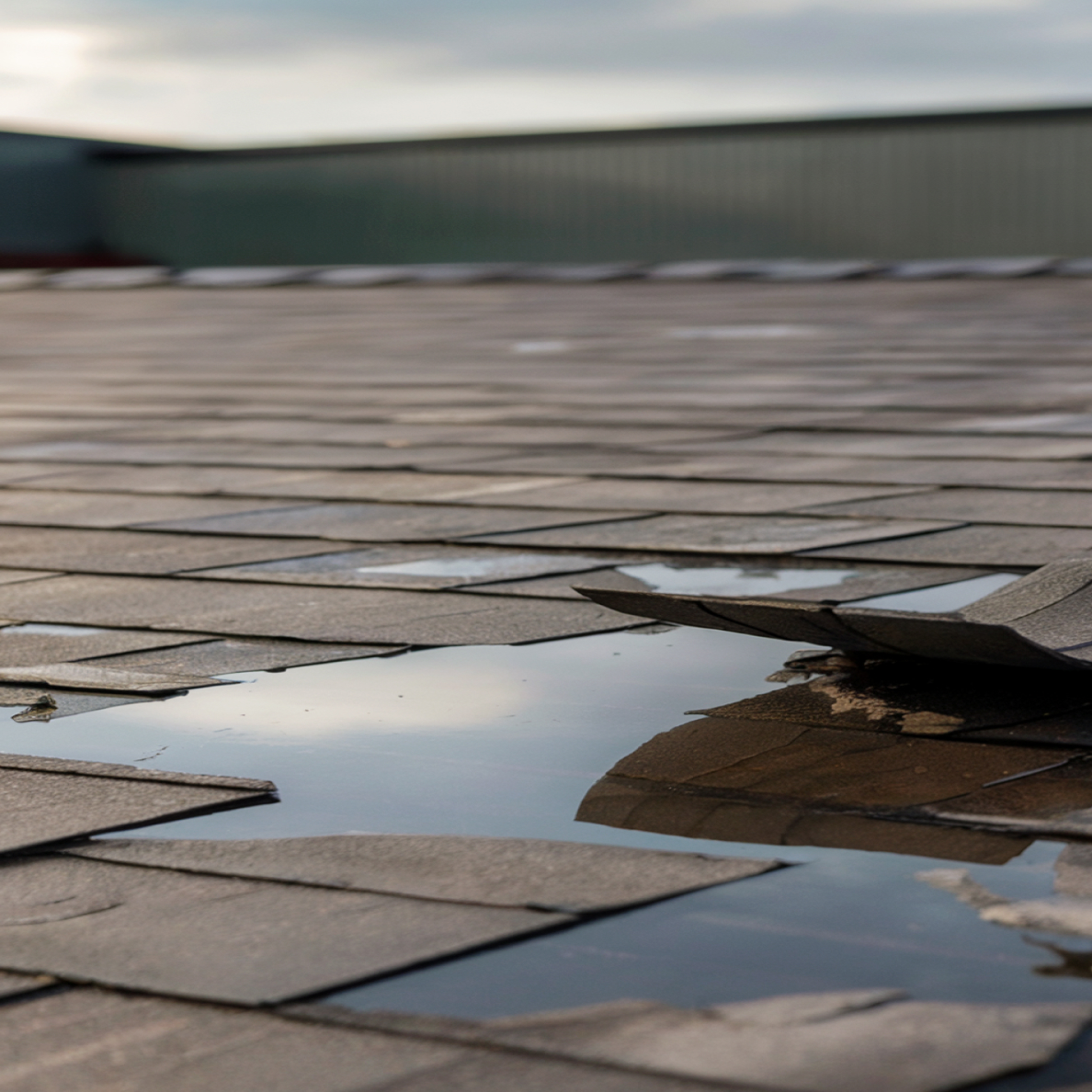
Differentiate your marketing materials and streamline facade and roof inspections with cinematic and thermal capture. Our pilots specialize in highlighting property features, site context, roof and facade conditions, and infrastructure access critical for commercial, industrial, and residential properties.
Improve accuracy, reduce fraud, and accelerate insurance claims processing and risk assessment. Our network provides rapid deployment for detailed property damage assessment (roofs, exteriors), pre-underwriting inspections, and large-scale catastrophe event documentation.
Access our network of specialized drone pilots across the United States. No matter where your project is located, we have certified professionals ready to deliver consistent, high-quality aerial intelligence.
1000+ Certified Pilots Nationwide
Deploy pilots to your project location within 24-48 hours, even rural areas.
Standardized equipment, protocols, and deliverables across our entire network.
Pilots familiar with regional regulations, weather patterns, and terrain challenges.
Access qualified pilots anywhere your projects take you, with consistent quality standards and deliverables.
Match with pilots experienced in your specific industry requirements and technical specifications.
Every pilot follows strict protocols for sensitive sites and data handling.
Receive professionally processed data in your preferred formats, ready for immediate use.
Quickly deploy multiple pilots across various locations for time-sensitive or large-scale projects.
Partner with Raad to offer your clients comprehensive aerial intelligence that enhances your analysis and recommendations. Our certified pilots capture precisely the data formats your systems require—from agricultural performance metrics to volumetric measurements—for seamless integration with your existing analytics platforms.
Transform raw aerial footage into actionable analytics for agriculture, construction, and infrastructure projects.
Specify your project needs, locations, timeline, and deliverable formats.
We identify qualified pilots with the right equipment and experience.
Select your preferred pilots and confirm mission parameters.
Get processed, analysis-ready data through our secure portal.
Seamlessly incorporate visual data into your existing workflows.
Every pilot in our network undergoes rigorous verification of certifications, insurance coverage, equipment maintenance, and operational procedures. Our ongoing quality assurance ensures consistent deliverables regardless of project location.
Commercial drone operation certification required for all professional pilots
Night operations, flying over people, and other special authorizations
Specialized training for specific industries and operations
Sign up to start your first campaign and see the difference Raad can make.