Drone tower inspections, priced before you commit

Drone inspections for cell towers, fiber routes, and new site builds. Precision tower capture, civil surveys, line-of-sight verification, and post-storm damage reports.

Order Now

No commitment. Order online in minutes.

FAA Part 107 Certified capture
24โ€“72 hrs Delivery time
Upfront Fixed pricing

Tower inspections without the climb

01

What makes tower inspections hard

Routine inspections put crews on structures at height. RF coverage is difficult to validate across varied terrain. Deployment planning is slow, and after a storm you need damage assessment faster than crews can be scheduled. Traditional methods are expensive, slow, and carry real risk.
02

What drone capture changes

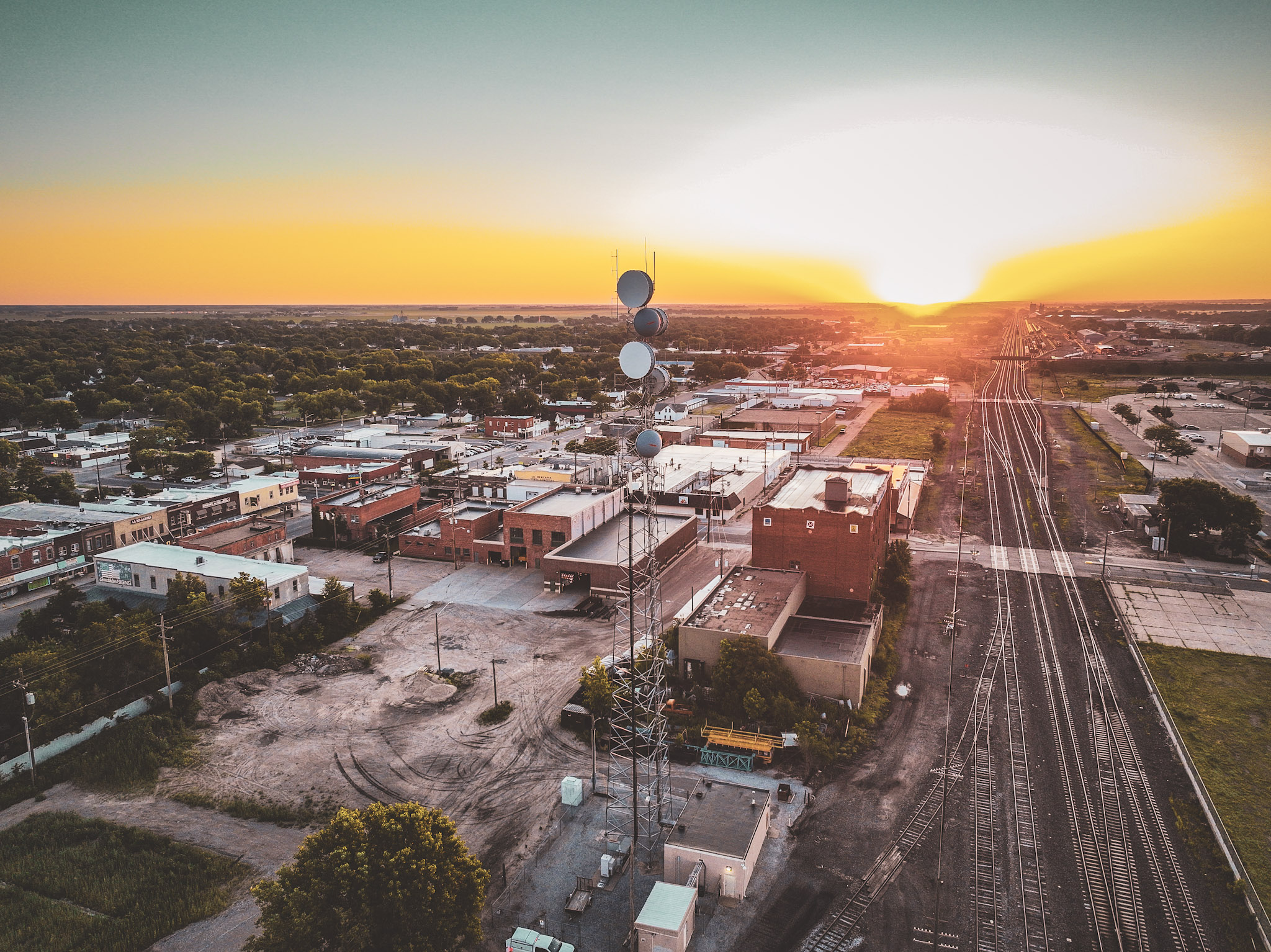
Specialist drone crews trained on telecom infrastructure, dispatched on demand. High-resolution visual and thermal capture for RF analysis, line-of-sight verification, and full site documentation, without putting anyone on the tower.

Built by telecom drone pilots

01

Why Raad exists

Raad was founded by drone pilots flying towers who were not satisfied with how the work was being done. Slow dispatch, inconsistent capture standards, data that arrived in formats nobody could use. Vetted pilots with deep telecom domain expertise, dispatched smartly, equipped with flight plans, and quality controlled.

02

Over 2,000 towers inspected

Drone inspections for structural assessment, RF mapping support, line-of-sight verification, and post-storm damage, flown for major US carriers, global engineering firms, and the telecom analytics platforms that process the data afterward.

03

41 states and three countries

Tower volume concentrated in the Northeast corridor from Upstate New York through NYC, Delaware and Pennsylvania, the Pacific Northwest across Oregon and Washington, California, and Texas. Coverage extends into Canada, Europe, Colombia, and Argentina, so one provider covers a footprint across the Americas without handing off at each border.

04

24-hour storm mobilization

After a weather event clears, drone crews mobilize within 24 hours for damage assessment and network restoration support.

Specialized aerial imagery services across the telecom lifecycle

01

Tower & equipment inspections

Close-range drone inspections of cell towers, antennas, mounts, cabling, and structural components. RGB and radiometric thermal capture detects defects, corrosion, and hazards without a climb.

02

RF mapping & analysis support

Capture precise geospatial data and high-resolution imagery to complement RF drive testing and propagation modeling, aiding coverage validation, interference hunting, and optimization efforts.

03

Line-of-sight (LoS) verification

Drone-flown point-to-point LoS verification for microwave links and new site placements, clearing terrain, vegetation, and building obstructions without a survey crew.

04

New site & construction monitoring

Capture detailed topographic data and aerial imagery for site planning and monitor the progress of new tower builds or small cell deployments.

05

Post-storm damage assessment

Rapidly deploy capture crews after severe weather events to quickly assess infrastructure damage, enabling faster network restoration and targeted repair efforts.

06

Vegetation management analysis

Identify and map vegetation encroachment near towers or along fiber routes for proactive maintenance planning.

Drone tower inspections start at $350

01

Typical range

Most single-tower drone inspections in the US fall between $350 and $900. No quote calls, no sales cycle. Configure your site and see the price before you comm

02

Remoteness

Metro sites price at the low end. Remote or hard-to-access towers carry higher mobilization cost.

03

Scope

Resolution, orbit density, and the number of angles required. A structural audit needs more passes than a post-storm damage check.

04

Capture, or capture plus processing

Raw imagery delivered as-flown sits below a package that includes orthomosaics, 3D models, or annotated defect reporting.

05

Volume

Per-tower pricing drops as site count rises. A 200-tower regional program prices differently from a one-off.

06

Civil component

Compound surveys, topographic capture, or as-built documentation alongside the tower itself.

Optimize network performance, safety, and your bottom line

01

Dramatically improve safety

Virtually eliminate the need for dangerous tower climbs for routine visual and thermal inspections.

02

Accelerate inspections & maintenance

Complete comprehensive inspections in a fraction of the time compared to manual methods, enabling faster repair cycles.

03

Enhance network planning data

Obtain precise, geo-referenced visual data and LoS verification to improve the accuracy of RF planning, site selection, and link budgets.

04

Reduce operational costs

Lower expenses associated with tower crews, lifts, insurance, and potential damage mitigation through early detection.

05

Improve compliance & documentation

Generate detailed, time-stamped visual records for maintenance logs, structural audits, regulatory filings, and asset management.
telecom image

Ready when you are

Pick your sites, see the price, and place your order โ€” no quotes, no sales calls.

Order Now